Last month, I wrote about how I used four primary sources—images and texts from revolutionary-era America—to introduce students to the concept of “cultural narratives” in my American studies course. Now I’d like to talk about another primary source discussion I found valuable this semester: one designed to shake up students’ mental picture of the United States at the end of the Revolution.
In 1783, around the time the American War was formally ending, the London publisher Carington Bowles released a “new map of North America and the West Indies” that attempted to capture the boundaries and larger context of the newly independent colonies. The Library of Congress has helpfully provided a high-resolution scan of the map, which has an almost alarming wealth of detail.
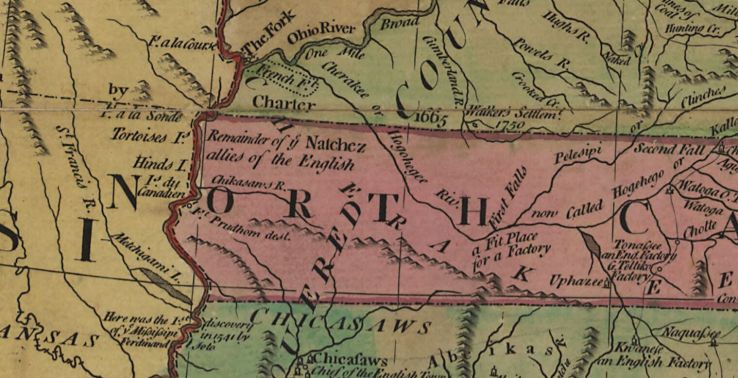
(To take an example at random: In what it considers western North Carolina, the map shows not only rivers and settlements but also notes about history and future prospects, labeling a “remainder of the Natchez allies of the English,” a putative location for the 17th-century Fort Prudhomme [“dest.”], and “a fit place for a [trading] factory.”)
In class, using the classroom computer and projector, I pulled up the map’s webpage.
Continue reading “American Narratives and Identities: Another Primary Source Activity”
